Tools
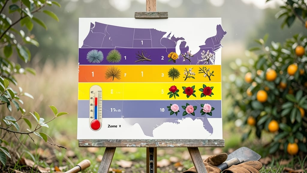
USA garden zones help you identify your local planting climate by organizing the country into numbered regions based on average annual minimum temperatures, which directly impacts which plants will thrive in your area. Use the USDA Plant Hardiness Zone Map or Sunset Western Garden Zone Map for precise location-based guidance.
Understanding USA garden zones means knowing your area's coldest winter temperatures, which dictate what plants can survive year-round. 🌱 The USDA system divides the country into 13 zones (1-13), each representing a 10°F temperature range, while Sunset's Western Garden Zones offer more localized precision for the western U.S. For example, Zone 7a (-10°F to 0°F) differs significantly from Zone 7b (0°F to 10°F) in terms of plant hardiness.
Many gardeners also account for microclimates—like urban areas that stay warmer or high-elevation spots that freeze faster—by adjusting their zone by half a number.
Finding your exact zone is simple: enter your ZIP code or address on the USDA Interactive Zone Map, which provides an instant visual of your location's zone.
For western gardeners, the Sunset Western Garden Zone Map offers 9 distinct regions with 40 subzones, accounting for factors like coastal fog and desert heat. I recommend cross-referencing both maps if you're in the western U.S., as they often reveal slightly different recommendations for the same location.
💡 In This Article
- How USDA Plant Hardiness Zones Work
- Tools to Locate Your Exact Garden Zone
How USDA plant hardiness zones work
The USDA Plant Hardiness Zone Map divides the U.S. into 13 numbered zones (1-13) based on the average annual minimum temperature of your area. Each zone represents a 10°F range—so Zone 5a (-20°F to -15°F) differs significantly from Zone 5b (-15°F to -10°F).
This system helps gardeners match plants to their local climate, as most perennials survive when winter temps stay above their hardiness threshold. For example, a Zone 6 plant like peonies can handle down to -10°F, while a Zone 8 citrus tree needs protection below 10°F.
What makes this system work is the 30-year average of coldest winter temps, recorded by NOAA weather stations. Scientists use 10°F increments because that's the typical range where plant survival shifts dramatically.
The map also accounts for elevation—mountains can be 3-5°F colder per 1,000 feet gained. 🌡️ For instance, Denver (Zone 5b) sits at 5,280 feet, while nearby Boulder (Zone 4b) is colder due to higher elevation, even though they're only 20 miles apart.
While the USDA map covers the entire country, it's less precise in the West.
That's where the Sunset Western Garden Zone Map comes in—it divides the western U.S. into 9 distinct regions with 40 subzones, accounting for factors like coastal fog (e.g., Zone 17 in San Francisco) or desert heat (e.g., Zone 24 in Phoenix).
Sunset's system also considers summer heat and humidity, which can stress plants even if winter temps are mild. For example, a Zone 7 plant in the Pacific Northwest might thrive, while the same plant in Arizona's Zone 10 could wilt from summer heat.
Minimum winter temperatures matter because plants enter dormancy when nights stay consistently cold.
If temps drop below their hardiness zone, cells freeze and rupture—like how an ice cube expands and cracks a glass. 🌿 This is why Zone 5 plants (e.g., Russian olive trees) survive in Chicago but die in Miami (Zone 10).
The USDA system simplifies this by grouping areas where plants behave similarly, but real-world factors like wind, soil, and urban heat islands can still create microclimates that require adjustments.
Here's how to visualize the difference: Imagine a Zone 6 garden in upstate New York versus a Zone 6 garden in the Sierra Nevada foothills. The New York garden might see 20°F dips, while the Sierra could drop to -5°F due to cold air pooling in valleys.
That's why gardeners in mountainous areas often plant one zone harder than their official zone to account for these extremes.
For practical application, think of zones like clothing sizes for plants. Just as you wouldn't wear a size 6 shirt in a size 10 body, you wouldn't plant a Zone 5 shrub in a Zone 8 climate without winter protection.
The USDA map gives you the baseline, but local conditions—like a south-facing wall that stays 5°F warmer—can create pockets where you can push boundaries.